INJIE Optics Laser Rangefinders for Forest Inventory and Timber Resource Management
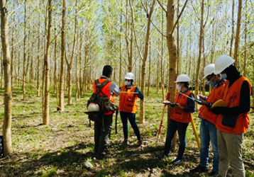
Forest inventory is the foundation of sustainable forestry management. Governments, forestry agencies, timber companies, environmental organizations, and research institutions all rely on accurate field data to evaluate forest resources, estimate timber volume, monitor ecosystem health, and support long-term conservation strategies.
Traditional measurement methods often require manual calculations, tape measurements, and repeated field visits. These approaches can be time-consuming, labor-intensive, and prone to human error.
INJIE Optics provides professional Laser Rangefinders designed to simplify forestry surveys through fast, accurate, and non-contact measurement. With advanced laser technology and intelligent measurement functions, INJIE helps forestry professionals collect reliable data while improving field efficiency.
Why Laser Rangefinders Are Essential for Forest Inventory
Forest inventory involves much more than measuring tree height. Survey teams must also evaluate stand density, spacing, terrain, and plot dimensions.
INJIE Optics laser rangefinders help users quickly collect critical data, including:
Tree height
Horizontal distance
Slope distance
Vertical height difference
Plot boundary measurements
Observation distances
Terrain angle
This information supports accurate forest resource assessments and improves decision-making throughout the management process.
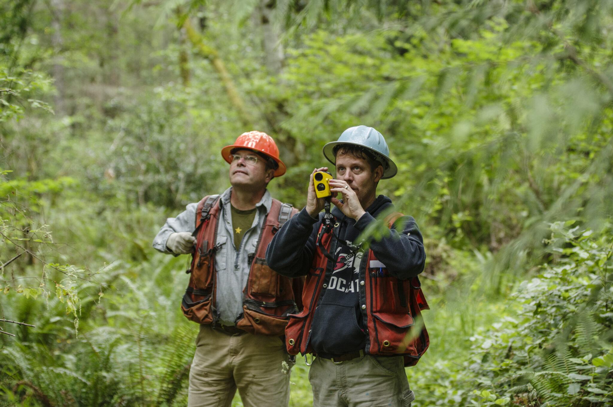
Efficient Tree Height Measurement Without Climbing
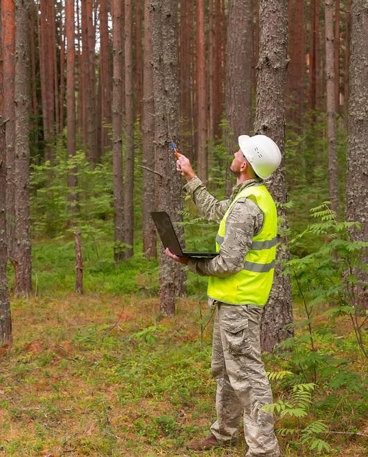
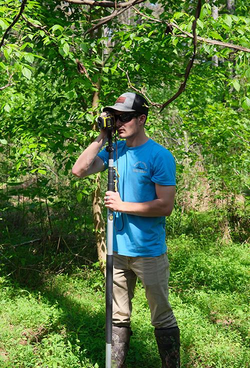
Measuring tree height is one of the most common tasks in forestry. Manual methods often require multiple operators and additional equipment.
INJIE Optics laser rangefinders allow users to determine tree height quickly using built-in angle compensation and distance calculations.
Advantages
Non-contact measurement
Reduced field time
Improved operator safety
Suitable for dense forests
High measurement repeatability
Easy operation for a single user
These features significantly increase productivity during forest inventory projects.
Support for Timber Volume Estimation
Accurate timber volume calculations depend on reliable field measurements.
Laser rangefinders provide precise distance and height information that supports the estimation of:
Standing timber volume
Average tree height
Forest growth rates
Harvest planning
Species comparison
Plantation management
Accurate inventory data helps forestry managers maximize resource utilization while promoting sustainable harvesting practices.
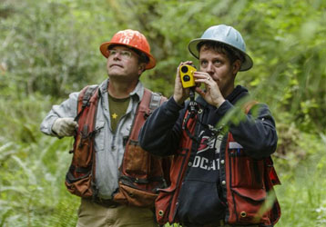
Improving Forest Boundary Surveys
Defining forest boundaries accurately is essential for land management and legal compliance.
INJIE Optics laser rangefinders assist survey teams by measuring:
Boundary distances
Road widths
Firebreak spacing
Watercourse crossings
Trail networks
Infrastructure locations
Fast distance measurement reduces manual work while improving survey accuracy.
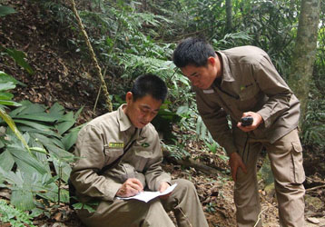
Forestry Applications in Environmental Conservation
Laser rangefinders are valuable tools for ecological monitoring and habitat protection.
Environmental organizations use INJIE Optics equipment to:
Monitor protected forests
Measure vegetation growth
Assess habitat restoration
Record ecological sampling plots
Evaluate reforestation projects
Support biodiversity conservation
Reliable field measurements contribute to long-term environmental research and sustainable resource management.
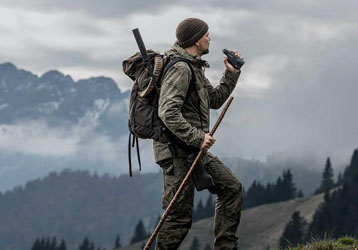
Rugged Performance in Outdoor Conditions
Forestry work often takes place in remote areas where weather conditions are unpredictable.
INJIE Optics laser rangefinders are engineered to perform reliably under demanding outdoor environments.
Outdoor Protection Features
Waterproof housing
Dust-resistant construction
Shock-resistant body
Anti-slip rubber armor
Fog-resistant optics
Long battery operating time
These features allow professionals to work confidently throughout the year.
Advanced Optical Performance
Reliable measurement begins with excellent optics.
INJIE Optics laser rangefinders incorporate premium optical components that deliver bright, sharp images in varying light conditions.
Optical Advantages
Multi-coated lenses
High light transmission
Wide field of view
Excellent color fidelity
Reduced optical distortion
Clear viewing during dawn and dusk
These features improve target acquisition and measurement accuracy in dense woodland environments.
Multiple Measurement Modes for Forestry Professionals
Modern forestry operations require versatile measurement tools.
INJIE Optics laser rangefinders support various working modes, including:
Single Distance Measurement
Continuous Scan Mode
Tree Height Measurement
Horizontal Distance
Vertical Distance
Angle Measurement
Speed Measurement (selected models)
Area Observation
Switching between measurement modes is quick and intuitive, allowing survey teams to adapt to different field tasks efficiently.
Ideal Forestry Applications
INJIE Optics laser rangefinders are suitable for:
Forest Inventory
Collect accurate resource data for long-term forest management.
Timber Harvest Planning
Measure stand characteristics before harvesting operations.
Reforestation Projects
Monitor planting density and evaluate forest regeneration.
Carbon Stock Assessment
Support environmental programs focused on carbon sequestration and climate research.
Forest Fire Prevention
Measure firebreak distances and assist emergency response planning.
Ecological Research
Gather spatial data for wildlife habitat studies and biodiversity monitoring.
Forest Infrastructure Development
Assist in the planning of roads, observation towers, bridges, and maintenance facilities.
OEM & ODM Manufacturing Services
INJIE Optics partners with forestry equipment suppliers, surveying companies, distributors, and government organizations worldwide.
We provide comprehensive customization services, including:
OEM manufacturing
ODM product development
Custom logo engraving
Brand packaging
Firmware customization
Multilingual user manuals
Product certification support
Global export logistics
Our experienced engineering and production teams ensure consistent quality and reliable delivery for international customers.
The Future of Digital Forestry Measurement
Forestry technology continues to evolve toward greater automation and data integration.
Emerging innovations include:
Bluetooth wireless data transfer
GPS-enabled positioning
GIS mapping compatibility
Cloud-based forestry databases
Mobile application integration
AI-assisted forest analysis
Multi-function environmental sensors
Laser rangefinder and drone collaboration
INJIE Optics is committed to developing intelligent measurement solutions that improve efficiency, support sustainable forestry, and meet the changing needs of global forest management.
Conclusion
Accurate field measurements are essential for effective forest management. From tree height measurement and timber inventory to ecological monitoring and wildfire prevention, INJIE Optics Laser Rangefinders provide dependable, high-precision solutions for forestry professionals.
Designed for challenging outdoor environments and supported by OEM/ODM manufacturing capabilities, INJIE Optics helps organizations around the world improve productivity, enhance data accuracy, and promote sustainable forest resource management.