









Long-Range Laser Rangefinder for Infrastructure Inspection: Applications, Benefits and Equipment Selection
Infrastructure inspection requires reliable observation and measurement tools, especially when facilities are distributed across large geographical areas or located in difficult-to-access environments.
Power transmission towers, communication facilities, bridges, industrial structures, and remote installations often require preliminary distance assessment before inspection personnel can organize their work.
A long-range laser rangefinder provides a convenient method for measuring distances to visible objects without physically approaching every target.
By combining optical observation and electronic distance measurement, these instruments can support field documentation, preliminary site evaluation, and remote infrastructure observation.
This article explores how long-range rangefinders are used in infrastructure inspection, their practical advantages, important technical characteristics, and key considerations for professional equipment selection.
What Is a Long-Range Laser Rangefinder?
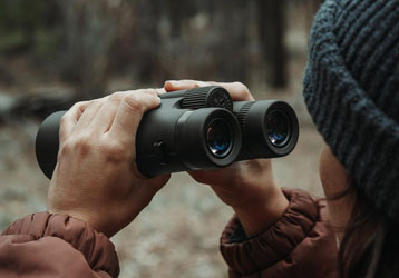
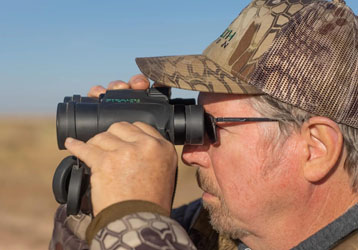
A long-range laser rangefinder is an optical electronic instrument designed to measure the distance between an observation point and a distant target.
Many modern devices operate using laser time-of-flight technology.
The instrument emits a laser signal toward a selected object and detects the returning reflection. Its internal processor calculates the distance and presents the result through a digital display.
Depending on the product configuration, additional functions may include:
Single-distance measurement
Continuous distance measurement
Optical magnification
Angle detection
Horizontal-distance calculation
Target priority modes
Digital measurement display
These features allow rangefinders to support different remote observation and field measurement requirements.
Why Infrastructure Inspection Needs Long-Range Measurement
Infrastructure facilities are frequently installed across large areas, elevated positions, or challenging terrain.
Inspectors may need to evaluate the approximate distance to a structure before planning additional observation or maintenance activities.
Traditional contact-based measurement can be inconvenient when the target is separated by rivers, valleys, restricted areas, or other physical obstacles.
A long-range rangefinder allows users to obtain preliminary distance information from an accessible observation position.
This approach can help improve fieldwork efficiency and reduce unnecessary movement.
However, rangefinder readings should not replace certified surveying methods or mandatory safety procedures when precise engineering measurements are required.
Application One: Power Transmission Infrastructure
Power transmission networks often include towers, poles, substations, and other facilities distributed across large geographical areas.
Some installations are located in mountainous regions, forests, or areas with limited road access.
A long-range laser rangefinder can assist inspection personnel by providing distance information to visible structures from a suitable observation point.
Potential applications include:
Preliminary observation of transmission towers
Distance assessment between observation positions and visible facilities
Supporting field inspection documentation
Identifying suitable remote observation locations
Collecting reference information for subsequent inspection activities
Personnel must follow applicable electrical safety requirements and maintain the required clearance from energized equipment.
A rangefinder should not be used as a substitute for approved electrical clearance measurement procedures.
Application Two: Communication Tower Inspection
Communication towers are commonly installed on rooftops, hills, mountains, and other elevated locations.
Their height and installation environment may make direct access difficult.
A long-range rangefinder can help inspectors estimate distances to visible tower structures from accessible positions.
Optical magnification can also assist with identifying the intended observation point.
When selecting equipment for this application, users may prioritize optical clarity, practical measurement distance, portability, and stable handheld operation.
Application Three: Bridge and Transportation Infrastructure
Bridge inspection frequently involves large structures extending across rivers, valleys, and transportation corridors.
Remote measurement equipment can support preliminary observation of accessible structural reference points.
A long-range rangefinder may be used to obtain distance information to visible bridge components from designated observation locations.
This information can assist with general field documentation and inspection planning.
For structural deformation monitoring or other precision-critical tasks, specialized measurement systems and approved engineering procedures are necessary.
Application Four: Industrial Facility Observation
Large industrial facilities may contain elevated structures, storage installations, pipelines, and equipment distributed across extensive sites.
Distance information can help inspection teams understand the approximate spatial relationship between observation points and selected structures.
A portable long-range rangefinder can support preliminary field assessment without requiring operators to move repeatedly between distant locations.
The instrument should be used only where laser operation is permitted and compatible with site safety requirements.
Application Five: Remote Infrastructure in Mountainous Areas
Remote infrastructure installations may be surrounded by steep slopes, valleys, vegetation, or uneven ground.
These environmental conditions can complicate direct measurement.
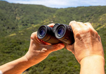
A long-range laser rangefinder allows operators to collect line-of-sight distance information from accessible observation positions.
Models equipped with angle measurement may also provide horizontal-distance calculations, which can be useful when the target and operator are located at different elevations.
Important Rangefinder Features for Infrastructure Inspection
Professional users should evaluate equipment according to actual inspection requirements.
| Feature | Practical Importance |
|---|---|
| Long measurement range | Supports observation of distant infrastructure |
| Optical magnification | Helps identify specific structural targets |
| Clear digital display | Makes readings easier to interpret |
| Continuous measurement | Supports repeated target assessment |
| Angle measurement | Provides additional terrain-related information |
| Horizontal-distance calculation | Useful when elevation differences exist |
| Portable construction | Supports mobile inspection activities |
| Environmental protection | Helps protect equipment during outdoor operation |
| Battery performance | Supports extended fieldwork |
Not every application requires every function. Equipment selection should reflect the actual working environment.
How Target Characteristics Affect Infrastructure Measurement
Different infrastructure surfaces can produce different measurement conditions.
A large building facade may provide a more suitable measurement target than a narrow cable or small structural component.
Surface material, orientation, target size, and surrounding objects can all influence laser signal reception.
Operators should select clearly identifiable targets whenever possible.
They should also avoid assuming that a rangefinder can reliably isolate a small structural feature simply because that feature is visible through the optical system.
Environmental Factors That Influence Measurement
Infrastructure inspection often takes place outdoors, where measurement conditions can change.
Rain and Fog
Water droplets and atmospheric moisture can scatter or weaken laser signals.
Dust and Haze
Airborne particles may reduce visibility and interfere with signal reception.
Strong Background Light
Bright environmental conditions can make target identification or display reading more challenging, depending on the instrument.
Instrument Movement
Small handheld movements may shift the aiming point, especially when measuring distant structures.
Physical Obstructions
Branches, fences, glass, and nearby structures may interfere with the intended measurement path.
Understanding these limitations helps users interpret unexpected readings.
Recommended Measurement Workflow for Field Inspectors
A structured workflow can make remote infrastructure measurement more consistent.
Identify the inspection objective.
Determine which structure or reference point requires measurement.
Select a safe observation location.
Choose an accessible position that complies with relevant site safety requirements.
Confirm target visibility.
Ensure the intended target is distinguishable from surrounding objects.
Stabilize the instrument.
Maintain a steady position while aiming and measuring.
Select the appropriate measurement mode.
Use the available function that matches the intended task.
Verify important readings.
Repeat measurements when results appear inconsistent.
Document the results.
Record the distance, target description, observation position, and relevant environmental conditions.
This approach supports organized field documentation and makes measurements easier to review.
How to Choose a Long-Range Rangefinder for Professional Inspection
Evaluate Practical Measurement Distance
Select equipment with measurement capabilities appropriate for the expected observation distances and target types.
Maximum advertised range should not be the only purchasing criterion.
Review Accuracy Specifications
Check the manufacturer's stated accuracy and testing conditions.
Compare Optical Performance
Optical clarity, magnification, and field of view influence how easily distant infrastructure targets can be identified.
Consider Environmental Protection
Review the device's stated protection rating and operating temperature range.
Evaluate Portability
A compact design can improve convenience when inspectors need to travel between multiple observation locations.
Check Battery and Power Options
Reliable power management is important during extended field activities.
Review Documentation and Technical Support
Professional buyers should consider product instructions, warranty information, and available technical assistance.
Common Questions About Infrastructure Rangefinders
Can a long-range rangefinder measure transmission towers?
Many models can measure suitable visible tower surfaces when the target is within the instrument's supported operating conditions.
Is a laser rangefinder suitable for bridge inspection?
It can support preliminary distance observation and field documentation. Precision structural inspection requires appropriate specialized instruments and procedures.
Can rangefinders measure through vegetation?
Vegetation may obstruct or interfere with the measurement signal. A clear line of sight is preferable.
Does optical magnification improve laser accuracy?
Magnification helps users identify and align with distant targets, but it does not independently determine the accuracy of the laser measurement system.
Are long-range rangefinders useful in mountainous environments?
Yes. Suitable devices can support remote distance measurement across valleys and uneven terrain.
What should professional buyers prioritize?
Practical measurement range, accuracy specifications, optical quality, environmental protection, portability, and technical documentation are important considerations.
Maintenance and Safety Recommendations
Proper maintenance helps preserve long-term equipment performance.
Clean optical surfaces using appropriate lens-cleaning materials.
Store the instrument in a protective case when transporting it between inspection locations.
Follow the manufacturer's recommendations for battery care, charging, storage, and environmental protection.
Inspect the equipment after exposure to rain, dust, or other demanding conditions.
Always comply with applicable laser safety requirements. Never direct the laser toward people, vehicles, or aircraft.
When working around electrical infrastructure, follow approved electrical safety procedures and maintain all required clearances.
Future Trends in Infrastructure Measurement Equipment
The development of portable optical instruments continues to create new opportunities for field inspection.
Potential improvements in long-range rangefinder technology include enhanced target detection, more efficient signal processing, improved optical systems, and clearer digital interfaces.
Integration with digital field documentation may also make it easier for inspection teams to organize and review measurement information.
As infrastructure networks expand, portable remote measurement equipment may continue to play a useful supporting role in preliminary field assessment.
Conclusion
Long-range laser rangefinders offer a practical method for obtaining distance information during infrastructure inspection and outdoor fieldwork.
Their combination of optical observation and electronic measurement can support preliminary assessment of power transmission facilities, communication towers, bridges, industrial structures, and remote installations.
By selecting equipment according to actual working conditions and following appropriate operating and safety procedures, inspection personnel can improve measurement efficiency and collect more organized field information.