









Best Laser Rangefinder for Forestry: A Complete Buying Guide for Forest Measurement and Environmental Management
Forestry professionals work in some of the world's most challenging environments. Dense vegetation, uneven terrain, changing weather conditions, and large survey areas require equipment that is accurate, durable, and easy to operate.
Whether conducting forest inventories, measuring tree heights, monitoring vegetation, or managing natural resources, selecting the right laser rangefinder can significantly improve field efficiency and data accuracy.
This guide explains the essential features of a professional forestry laser rangefinder and why INJIE Optics provides dependable laser measurement solutions for forestry professionals worldwide.
Why Laser Rangefinders Are Important in Forestry
Traditional forestry measurements often rely on manual tools, measuring tapes, clinometers, and estimation techniques. While effective in certain situations, these methods can be time-consuming and may require multiple operators.
Professional laser rangefinders offer several advantages:
Faster data collection
Improved measurement consistency
Reduced physical effort
Non-contact measurements
Better safety in difficult terrain
As forestry management becomes increasingly digital, laser rangefinders have become essential tools for field professionals.
Common Forestry Applications
Tree Height Measurement
Tree height is one of the most frequently recorded forestry parameters.
Laser rangefinders equipped with height measurement functions help users estimate tree height quickly without climbing or making physical contact.
Typical applications include:
Timber evaluation
Forest inventory
Carbon stock assessment
Growth monitoring
Forest Inventory
Forest inventories involve collecting information about:
Tree species
Tree spacing
Stand density
Forest boundaries
Vegetation distribution
Laser rangefinders help improve survey efficiency while reducing manual measurement time.
Environmental Monitoring
Environmental agencies and conservation organizations use laser rangefinders to support:
Habitat assessment
Ecological restoration
Protected area management
Wetland monitoring
Biodiversity studies
Accurate distance measurements contribute to reliable field data collection.
Forest Road Planning
Building and maintaining forest roads requires careful measurement of:
Road alignment
Slope distance
Terrain elevation
Safety clearance
Laser rangefinders help engineers and forestry managers make informed planning decisions.
Key Features to Look for in a Forestry Laser Rangefinder
Long Measurement Range
Forests often contain large open areas as well as dense vegetation.
Choose a model capable of measuring across clearings, valleys, or forest compartments while maintaining reliable accuracy.
High Optical Quality
Professional optical performance helps users identify distant targets in low-light environments such as dense forests.
Look for:
Fully multi-coated lenses
High light transmission
HD optical glass
Bright image quality
Height Measurement Function
Tree height measurement is one of the most valuable features for forestry professionals.
Integrated height calculation improves efficiency and eliminates many manual calculations.
Angle Measurement
Mountain forests often involve uneven terrain.
Angle measurement helps users calculate:
Horizontal distance
Slope distance
Tree position
Terrain characteristics
Continuous Scan Mode
Continuous scanning is useful when measuring multiple trees or surveying large forest areas.
It allows rapid measurement without repeatedly restarting the ranging process.
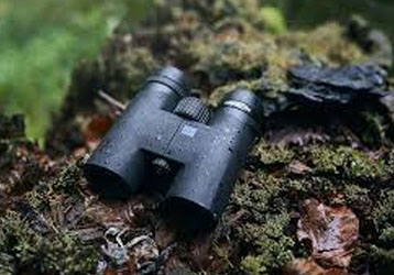
Rugged Outdoor Design
Forestry equipment must withstand demanding environments.
Professional models should offer:
Waterproof construction
Dust resistance
Shock-resistant housing
Comfortable grip
Long battery life
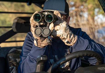
Handheld Laser Rangefinder or Laser Rangefinder Binocular?
Both devices have advantages in forestry.
Handheld Laser Rangefinder
Best for:
Daily forest inventory
Tree measurement
Forest engineering
Mobile field surveys
Advantages:
Compact size
Lightweight
Easy one-hand operation
Laser Rangefinder Binocular
Best for:
Wildlife observation
Long-distance forest monitoring
Mountain surveys
Conservation projects
Advantages:
Comfortable dual-eye viewing
Better target identification
Extended observation sessions
Many forestry organizations use both types depending on operational requirements.
Best Practices for Forestry Measurements
To achieve consistent measurement results:
Choose Clear Targets
Whenever possible, aim at unobstructed sections of the tree trunk or canopy.
Avoid Heavy Rain or Dense Fog
Weather conditions can reduce laser signal quality and effective measurement range.
Keep the Lens Clean
Dust, pollen, and moisture can reduce optical clarity.
Use appropriate lens-cleaning tools before fieldwork.
Measure More Than Once
For important forestry records, repeat measurements and compare results to improve confidence in the data.
Why Forestry Professionals Choose INJIE Optics
INJIE Optics develops professional laser measurement equipment designed for demanding outdoor environments.
Our solutions combine:
Precision laser ranging
Advanced optical systems
Intelligent measurement functions
Rugged construction
Ergonomic operation
Applications include:
Forestry
Environmental monitoring
Agriculture
Land surveying
Infrastructure inspection
Outdoor exploration
OEM & ODM Services
INJIE Optics also supports global partners with flexible manufacturing services.
We provide:
OEM production
ODM product development
Private-label branding
Packaging customization
Technical documentation
International logistics support
Whether you are a distributor, importer, or outdoor equipment brand, our team can help develop products tailored to your market.
Frequently Asked Questions
Can laser rangefinders measure tree height?
Yes. Many professional models include height measurement functions that estimate tree height using laser distance and angle calculations.
Are laser rangefinders suitable for dense forests?
Yes. Performance depends on the target visibility and environmental conditions. Choosing clear targets and maintaining steady operation will generally improve results.
What is the difference between a forestry laser rangefinder and a standard distance meter?
Forestry laser rangefinders typically offer additional functions such as height measurement, angle calculation, and long-range outdoor performance, making them more suitable for field applications.
Does INJIE Optics support customized forestry equipment?
Yes. We offer OEM and ODM services, including product customization, private labeling, and packaging solutions for global partners.
Conclusion
Modern forestry requires reliable, efficient, and accurate measurement tools. A professional laser rangefinder helps forestry professionals collect better data, improve productivity, and support sustainable forest management.
With advanced optical engineering, intelligent laser technology, and rugged outdoor design, INJIE Optics provides dependable measurement solutions for forestry professionals, environmental organizations, and outdoor specialists worldwide.
INJIE Optics — Precision Laser Measurement for Smarter Forestry Management.
SEO Meta Title
Best Laser Rangefinder for Forestry | Tree Height Measurement & Forest Survey | INJIE Optics
SEO Meta Description
Learn how to choose the best laser rangefinder for forestry applications, including tree height measurement, forest inventory, environmental monitoring, and land management with INJIE Optics.