









Laser Rangefinders for Surveying: Improving Accuracy in Civil Engineering and Construction Projects
Accurate measurement is the foundation of every successful construction and civil engineering project. From initial land surveys and site planning to infrastructure development and structural inspections, engineers and surveyors rely on precise distance data to ensure project quality, safety, and efficiency.
Traditional surveying methods often require multiple workers, physical contact measurements, and complicated calculations. With the development of laser technology, professional laser rangefinders have become essential tools for modern engineering applications.
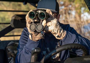
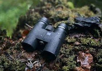
The INJIE Optics Multifunction Laser Rangefinder combines advanced laser measurement technology, professional optical systems, and intelligent calculation functions to provide reliable solutions for surveying, construction, and infrastructure projects.
Why Laser Rangefinders Are Important in Surveying
Surveying requires accurate information about:
Distance
Height
Angle
Position relationships
Terrain conditions
Even small measurement errors can affect:
Construction costs
Project schedules
Structural safety
Engineering quality
Laser rangefinders improve surveying efficiency by providing:
Fast non-contact measurement
High precision data
Easy operation
Reduced manpower requirements
Applications of Laser Rangefinders in Civil Engineering
1. Land Surveying and Site Preparation
Before construction begins, engineers must understand the site environment.
Laser rangefinders assist with:
Land boundary measurement
Site dimension verification
Terrain evaluation
Construction planning
Benefits include:
Faster field surveys
Improved measurement consistency
Reduced manual work
2. Building Construction Measurement
During construction, accurate measurements are required at every stage.
Common applications include:
Building height measurement
Distance verification
Structural alignment checks
Installation planning
INJIE laser rangefinders allow engineers to collect measurement data quickly without requiring direct access to every location.
3. Bridge and Infrastructure Projects
Large infrastructure projects often involve difficult measurement conditions.
Applications include:
Bridge inspection
Road construction
Railway projects
Tunnel engineering
Highway maintenance
Laser measurement technology helps engineers evaluate large structures safely and efficiently.
4. Structural Inspection and Maintenance
After construction, regular inspection ensures long-term safety.
Laser rangefinders support:
Structural deformation monitoring
Distance verification
Facility assessment
Maintenance planning
Non-contact measurement reduces the need to approach dangerous areas.
5. Interior Construction and Renovation
Laser rangefinders are also valuable for indoor applications.
Used by:
Architects
Interior designers
Contractors
Building managers
Applications include:
Room measurement
Ceiling height measurement
Space planning
Equipment installation
Advantages of INJIE Laser Rangefinder for Engineering Applications
High Measurement Accuracy
Professional laser technology provides reliable measurement results for demanding engineering tasks.
Advantages:
Fast response
Stable performance
Repeatable results
Reduced human error
Long-Distance Measurement Capability
Engineering projects often involve large structures and open areas.
Long-range measurement helps users:
Measure distant buildings
Inspect infrastructure
Evaluate large construction sites
without unnecessary movement.
Multiple Measurement Functions
Modern INJIE laser rangefinders may support:
Distance Measurement
Basic measurement for construction and surveying.
Height Calculation
Useful for:
Buildings
Towers
Bridges
Utility structures
Angle Measurement
Important for:
Sloped terrain
Mountain construction
Infrastructure projects
Continuous Scanning
Helps collect multiple measurements efficiently.
Laser Rangefinder vs Traditional Surveying Tools
| Feature | Traditional Tools | Laser Rangefinder |
|---|---|---|
| Operation | Manual | Digital |
| Measurement Speed | Slower | Faster |
| Contact Required | Usually Yes | No |
| Single Operator | Difficult | Easy |
| Long Distance | Limited | Excellent |
| Data Reliability | Depends on user | More consistent |
Laser technology does not completely replace professional surveying systems, but it significantly improves efficiency for many measurement tasks.
How to Choose a Surveying Laser Rangefinder
1. Measurement Range
Choose a model based on project requirements.
Construction projects may require:
Short to medium range measurement
Large infrastructure projects may require:
Long-distance capability
2. Accuracy Requirements
Engineering projects should prioritize:
Measurement stability
Repeatability
Reliable calibration
3. Environmental Protection
Construction sites can be demanding.
Recommended features:
Waterproof protection
Dust resistance
Shock resistance
Temperature adaptability
4. Optical Performance
Good optics improve:
Target identification
Measurement success
User experience
5. Data Functions
Advanced models may include:
Bluetooth transmission
Data storage
GPS integration
Mobile connection
These features improve digital workflows.
INJIE Optics Professional Engineering Solutions
INJIE Optics develops professional optical and electro-optical products for global customers.
Our solutions support:
Construction companies
Engineering contractors
Surveying organizations
Infrastructure developers
Industrial inspection teams
Product categories include:
Laser Rangefinders
Laser Rangefinder Binoculars
Thermal Imaging Devices
Night Vision Equipment
Professional Optical Instruments
OEM & ODM Manufacturing Services
For global engineering equipment brands and distributors, INJIE provides:
Product Customization
Including:
Brand logo
Product appearance
Packaging design
User manuals
Technical Development
Including:
Hardware optimization
Optical system development
Function customization
Product improvement
Manufacturing Support
Including:
Quality control
Production management
Export support
After-sales assistance
Future Trends in Engineering Laser Measurement
The future of construction measurement will become more intelligent.
Emerging technologies include:
AI-Assisted Measurement
Artificial intelligence can help identify targets automatically and improve measurement efficiency.
Digital Construction Integration
Laser measurement data will increasingly connect with:
BIM systems
Mobile devices
Cloud platforms
Multi-Sensor Integration
Future equipment may combine:
Laser ranging
Thermal imaging
Digital cameras
GPS positioning
to create complete engineering measurement platforms.
Frequently Asked Questions
Can laser rangefinders replace professional surveying instruments?
Laser rangefinders are excellent supplementary tools for many measurement tasks, but complex surveying projects may still require specialized surveying equipment.
Are laser rangefinders suitable for construction sites?
Yes. Professional models are designed for construction environments and provide fast, non-contact distance measurement.
What accuracy can professional laser rangefinders achieve?
Accuracy depends on the model, measurement distance, target conditions, and environment. Professional devices are designed to provide reliable results for their intended applications.
Does INJIE Optics provide customized engineering measurement solutions?
Yes. INJIE supports OEM and ODM services for professional optical measurement products.
Conclusion
Modern engineering requires faster, safer, and more accurate measurement solutions. Laser rangefinders provide construction professionals and surveyors with powerful tools that improve productivity and reduce measurement challenges.
With advanced laser technology, professional optics, and intelligent measurement functions, INJIE Optics Laser Rangefinders provide reliable solutions for civil engineering, construction, infrastructure inspection, and surveying applications.
INJIE Optics — Precision Measurement Technology for Modern Engineering.